Thursday, October 10, 2019

things to do in Colorado

Pikes Peak does not look interesting to me: Image result for view from pikes peak summit

Top scenic drives in CO:
https://www.tripadvisor.com/Attractions-g28927-Activities-c47-t74-Colorado.html

#1 Trail Ridge Road: Trail Ridge Road is the highest continuous paved road in the United States. Known appropriately as the "Highway to the Sky," it crosses the Continental Divide at a whopping 12,183 feet. Colorado has also designated Trail Ridge Road as a scenic and historic byway.   Ends in Estes.

Best trail in Estes: Emerald Lake Trail is also the best trail in all of Colorado:   https://www.alltrails.com/trail/us/colorado/emerald-lake-trail  "Emerald Lake Trail is a 3.1 mile heavily trafficked out and back trail located near Estes Park... The trailhead is at the end of Bear Lake Road - a short drive from Estes Park in Colorado.  Hikers will pass pristine alpine lakes including Nymph Lake and Dream Lakes and be treated to beautiful views of rocky peaks including Flattop Mountain, Hallett Peak and Glacier Gorge. … It took us an 1.25 hours there and back stopping many times to take pictures. "


********************San Juan Scenic Byway: *******************************
 A spectacular scenic drive stretches from the old mining town of Silverton, to the town of Ouray, along what is called the Million Dollar Highway. This is a 46-kilometer two-lane highway that hugs the mountainside in places and looks out over jaw-dropping cliffs and across valleys to inspiring mountain peaks. It is one of the most spectacular mountain drives in Colorado.
https://www.planetware.com/tourist-attractions/colorado-usco.htm
Image result for san juan scenic byway colorado

Ice Lake Basin Trail in San juan National Forest is 8 miles.  I don't know if we can spend a whole day doing one hike.

OR there are hot springs in Ouray for something to do along the San Juan Scenic Byway. 
OR Old Hundred Gold Mine https://www.tripadvisor.com/Attraction_Review-g33646-d1734410-Reviews-Old_Hundred_Gold_Mine_Tour-Silverton_Colorado.html
https://www.tripadvisor.com/Attraction_Review-g33646-d1734410-Reviews-Old_Hundred_Gold_Mine_Tour-Silverton_Colorado.html
"Really interesting

Very unpretentious, value for money experience, brought to life by a tour guide who knew a lot about mining. We came away with a much better appreciation of the life of a miner past and present, and no question was too much trouble for our guide. Great was to spend an hour or two, 5 miles or so out of Silverton. "
********************************************************************************* Dinosaur to Estes is a 6 hour drive.  Sounds like a crappy day.  
Dinosaur to Aspen is a 4.5 hour drive.  Maroon Bells are near Aspen.
Aspen to Estes via Kremmling puts us on the Trail Ridge Road and takes 4.75 hours. 

*****************************Dinosaur****************************************
Places to see petroglyphs in Dinosaur National Monument: https://www.nps.gov/dino/learn/historyculture/viewing-petroglyphs-and-pictographs.htm

https://www.nps.gov/dino/learn/historyculture/viewing-petroglyphs-and-pictographs.htm
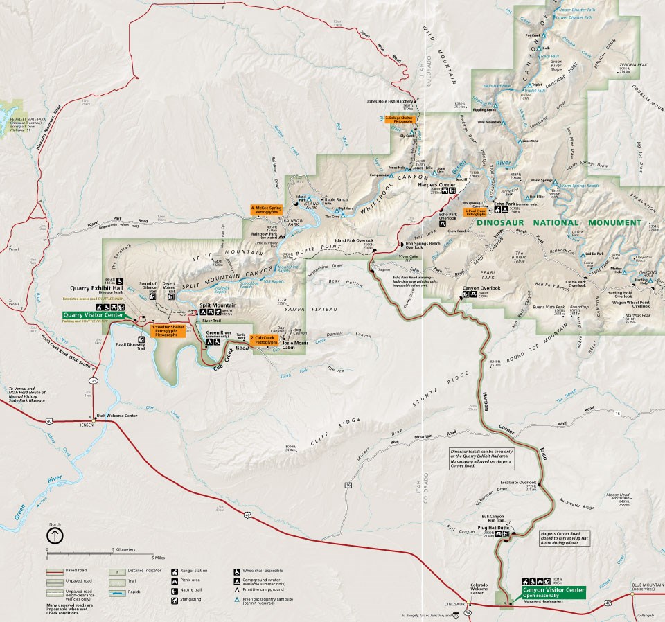
a map of Dinosaur National Monument showing the main petroglyph sites

There are white water rafting day trips in Dinosaur that stop at petroglyphs for $119+$15/persson. 
https://www.oars.com/adventures/split-mountain-utah-whitewater-rafting/
OR https://adrift.com/utah-whitewater-rafting/
Image result for split mountain rafting reviews

********************************************************************************************
Top Attractions in Colorado: 
Great Sand Dune National Park
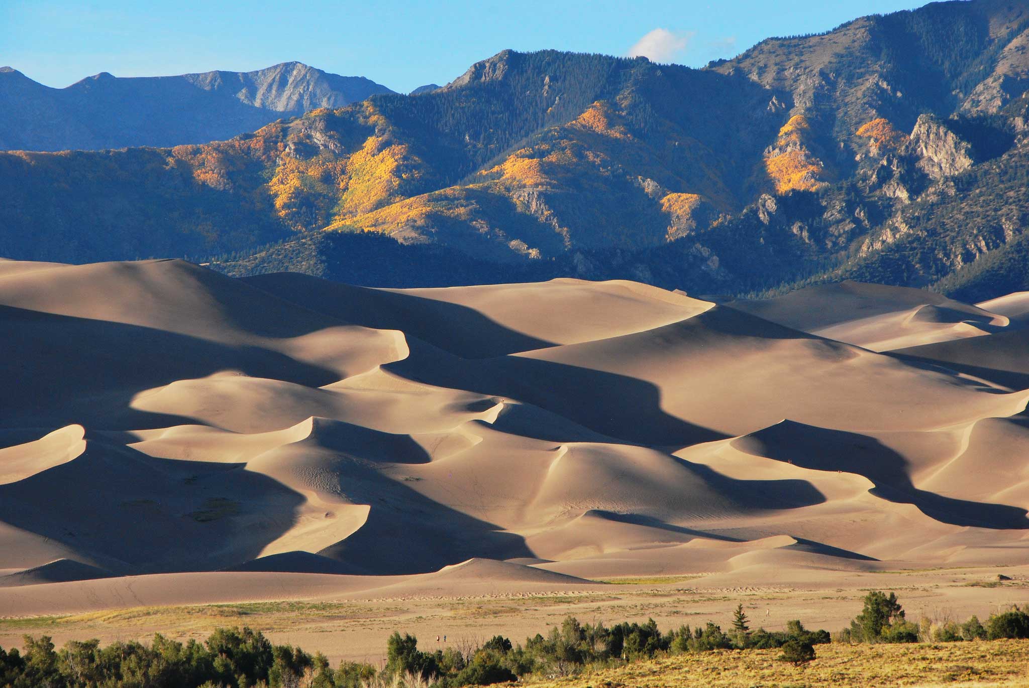
Image result for great sand dune national park
High Dune Trail is a 3 mile heavily trafficked out and back trail located near Mosca, Colorado that features a river and is rated as difficult. Nice views from the top. Trailhead has changing rooms and outdoor showers to clean up after the hike. There is a small store just outside the park that rents sand boards to surf down the dunes. We missed it driving in so didn't get the chance to surf but it looked fun.


34 h (1,967 miles) - ()
Great Sand Dunes to Old Hundred Mine: 4.5 (Great Sand Dunes adds 2 hours)
Old Hundred to Cliff Palace Mesa Verde: 2 hr 40 min (Cliff Palace adds 2 hours) 
Old Hundred to Moab: 4 hr (Moab adds 34 minutes) (Old Hundred adds 3 hours in San Juan Ntl Forest)
Moab to Zion: 5 hr 21min (Zion adds 3 hours) 
Moab to Bryce: 4 hr 26 min
Moab to Escalante: 4 hr 1 min
Cliff Palace to Zion: 6 hr 42 min
Cliff Palace to Bryce: 7 hr 15 min
Cliff Palace to Escalante: 6 hr 56 min
Cliff Palace to Moab: 2 hr 55 min
Escalante to Dinosaur/Vernal: 5 hr 49 min
Escalante to Moab: 4 hr
Moab to Dinosaur/Vernal: 3 hr 41 min (Dinosaur adds 2 hours) 
Bryce to Little Wild Horse Canyon: 3 hr 47 min (Little Wild Horse Canyon adds 2 hrs)
Little Wild Horse Canyon to Dinosaur/Vernal: 4 hr 35 min
Dinosaur to Emerald Lake: 6 hrs 6 min (Emerald Lake adds 2 hours) 

The problem is that Dinosaur and Estes are very far from everything else and add long (6+ hours) days of driving which results in hotel and food charges, but no real vacationing/experiencing.  Consider arriving Denver, and leaving from Las Vegas, or vice versa.  That would mean skipping the white water rafting, or doing it in a different place than Dinosaur.

***********************************ASPEN*************************************
Maroon Bells "This was the reason for going to Aspen and I wasn't disappointed. It is a bit of a challenge to get to. The buses are your best bet as parking is a problem. We took a bus from downtown to the Highlands and then they have buses running to the Bells. I do think this is a must see, gorgeous peaceful and spiritual." "Because of the crowds, private vehicles are not allowed during tourist season between 8 AM - 5 PM. Bus transportation is required during those hours"

There is a 1.8 mi easy hike, or a 3.6 mi moderate


https://www.stayaspensnowmass.com/sites/default/files/MaroonBells.pdf
"Developed Campgrounds:


Reservations: 

Call Toll Free 1 (877) 444-6777 (International (518) 885-3639 or TDD (877) 833-6777) or reserve on-line at www.recreation.gov.

Food Storage:

Storing food properly is required when camping in the developed campgrounds in the Maroon Bells area. Please seal and store food in a container inside a vehicle or in bear boxes provided at the campsite."
" You can hike on this road in the winter but it is a 12 mile round trip to make it to the lake. The road is open to all Non-Motorized forms of transportation at no charge. (bicycles, skateboarders, hikers, rollerbladers, etc...).  Buses are expected to run every 30 minutes from the Buttermilk lot to Aspen Highlands. There is a $10 recreation use fee for driving to the Maroon Bells. Cash or check only. You must catch the bus to the Maroon Bells at Aspen Highlands. Leashed dogs are allowed on the bus."


Sunday, October 6, 2019

driving from MD, includes CO scenic drives

34 hour drive MD to Zion through West Virginia, Kentucky, Missouri, Kansas, Colorado OR
Pennsylvania, Ohio, Illinois, Indiana, Nebraska, Colorado

2300 mi/12 mpg * 2.75 $/gal = $527 in gas for an RV or a pickup towing a trailer


Southern Route: 
Day 1: MD to Hocking Hill State Park, OH, 6.5 hours
Day 2: OH to Garden of the Gods, IL, 7 hours
Day 3: IL to Ozark National Scenic Riverway, 3.5 hours
Day 4: Elk City State Park, KS, 5 hours
Day 5: Lake Scott State Park, KS, 5 hours
Day 6: Vail, CO: 6 hours
Day 7: Bryce, UT, 7 hours

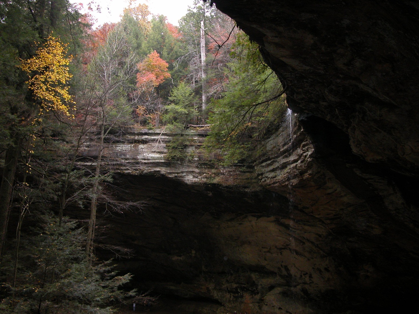
Day 1: Hocking Hill State Park OH with Corkscrew Falls, Rock House and Ash Cave, 6.5 hours from MD.  Ledges and Brandywine Gorge Trail in Kuyahoga State Park are higher rated, but the pictures don't look as cool.
Image result for hocking hills state park ohio

Garden of the Gods, Herod, IL, 7 hours from Hocking Hill State Park.  This is the #3 trail in IL.  Little Grand Canyon is #1 and looks interesting as well, but is 45 min further away.  7 hours is a long day of driving to begin with.
Image result for garden of the gods illinois

Ha Ha Tonka State Park, Camdenton, MO 5.25 hours from Garden of the Gods: Ha Ha Tonka consists of 3,752 acres and has just over 17 miles of walking trails. The state park has many interesting and unique features, including sinkholes, caves, bluffs, and a natural bridge. It is also the home to Missouri’s 12th largest spring and the ruins of a turn of the century stone castle that burnt down

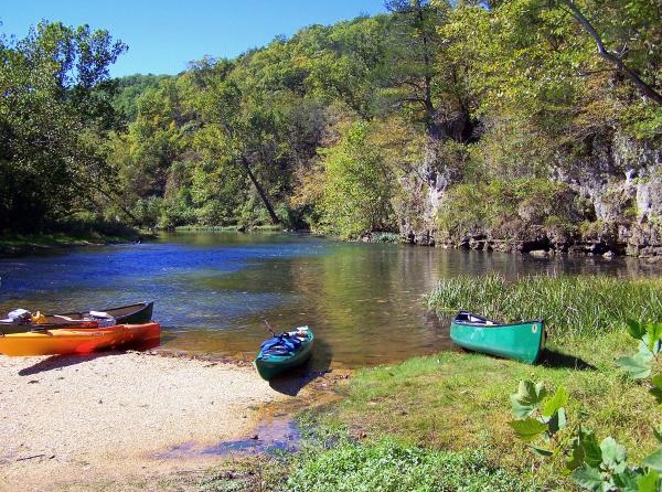
*OR* Ozark National Scenic Riverway, 3 hours 20 min from Garden of the Gods

*OR* Glade Top Trail This gorgeous 23-mile drive is the state's only National Forest Scenic Byway; it includes the Mark Twain National Forest and the Hercules Glades Wilderness Area. Be sure to stop at the route's multiple overlook pull-outs to see jaw-dropping panoramic views of the surrounding countryside.
For twenty-three miles, the two-lane, all weather gravel road follows narrow ridge tops rising approximately 500 feet above the surrounding rolling countryside, and overlooks and passes through many limestone/dolomite glades interspersed with open and closed woodlands and forests.
Missouri has among the greatest abundance and diversity of glades in the United States and the Glade Top Trail lies within the heart of some of the best remaining examples of this unique natural community.
For hiking near there, Coy Bald Trail in Hercules-Glade 
Alternate Text
Elk City State Park, KS, 5 hours: The Elk River Hiking Trail has been designated as a National Recreation Trail under the U.S. Department of the Interior's National Trail System and Backpacker magazine has rated it the best hike in Kansas.  The trail treats the walker to an adventure in southeast Kansas on the cusp of the Chautauqua Hills and Osage Cuestas region.

TRAIL DESCRIPTION
The Hiking Guide to Kansas by Catherine Hauber & John Young describes the trail like this:
"The trail, which winds along a rocky ridge on the north side of the lake, travels along sheer rock walls, under rock canopies, through rock tunnels and chambers, up rock steps to bluffs overlooking the lake, and around giant boulders, sometime balanced precariously on end in seeming defiance of gravity.  We were fascinated by the mushroom-like rocks, table rocks, ledges, and a rock hollow carved by a small waterfall."

Image result for elk city state park table mound hiking trail ks
Lake Scott State Park, KS 5 hours from Elk City


Vail, CO 6 hours from Lake Scott State Park, KS
shutterstock_348474848 (1)

Or instead of Vail, do Great Sand Dunes National Park, CO which also puts us driving through Moab.
Image result for great sand dunes national park

Bryce: 7 hours from Vail, CO or 4.5 hours from Moab, UT

Escalante:

Zion: 

Salt Lake City: 4.5 hours

American Heritage Center, Larame, WY: 6 hours

OR Dinosaur National Monument in UT/CO and then the #1 scenic drive through CO to Estes
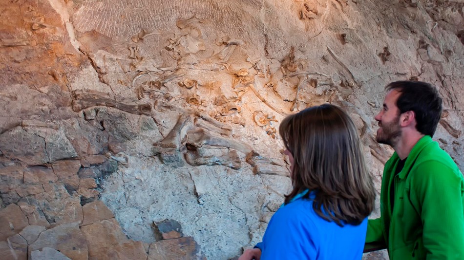
Image result for dinosaur national monument
Image result for trail ridge road, co

Scenic Driving tour of the Sandhills region of Nebraska: 7 hours

No. 1 – Sandhills Journey

Starting Location: Grand Island, NE
Ending Location: Alliance, NE
Length: 272 miles
Best Season to Drive: Spring, Summer, and Fall
See this drive on Google Maps
This route along Nebraska’s Highway 2 has frequently been deemed one of the most scenic drives in the country, and it doesn’t take travelers long to see why. Before setting off, explore the city of Grand Island and all of its offbeat cultural venues or enjoy a hiking trail through the prairie. The highway later passes through the Nebraska Sandhills - a 20,000 square mile stretch of rolling dunes covered in soft grass - with the hand-planted Nebraska National Forest standing like an oasis in the desert right in the middle of it all.

Could drive directly to the Nebraska National Forest in Natnick, NE, and then finish the Sandhills Journey in Grand Island, NE.

Grotto of the Redemption, Iowa: 5.5 hours.  Most of the cool Iowa drives run North/South along a river.  Not conducive to making progress toward home.

Chicago, IL: 7 hours.  Who knows what we could do here.  One of the highest rates sites is the giant silver bean.  That would take about 5 minutes to see.

Cedar Point Amusement, OH: 5 hours  At this point we are sick of mountains, trees, and rocks.  

Maryland: 7 hours


Tuesday, October 4, 2016

non hiking things to do

http://www.kanabzipline.com/ $80 (270 lb weight limit)

ATV ($288/person, 240lb limit), zip line ($160, 240 lb weight limit), canyoneering ($160, 5-6 hours): http://www.paragonadventure.com/


Monday, October 3, 2016

scenic driving in UT


"Leave for Bryce Canyon National Park (approx. 86 miles). Enjoy the scenic drive through Zion Hwy 9 and HWY 89. Pass through historic towns and beautiful Red Canyon.
At Bryce Canyon, visit some of the scenic overlooks. If you're looking to relax a little, stay nearby and visit the closer viewpoints. For sunset, we recommend Inspiration Point, Paria View or Sunset Point, and plan to arrive one-and-a-half hours before sunset for the best lighting. If you want to see mostly all of Bryce Canyon, drive or take the shuttle on the scenic loop. It's 38 miles (one way) of pure beauty and you will cover many viewpoints.
View Points of Scenic Loop:
Swamp Canyon
Piracy Pointe
Fairview Point
Aqua Canyon
Natural Bridge
Ponderosa Canyon
Black Birch Canyon
Rainbow Point
Yovimpa Point"  https://utah.com/itinerary/grand-circle-tour

Capitol Reef Scenic Drive: 7 mile out and 7 miles back, cost $10 to drive here are the scenic points;

Panorama Point (also called Goosenecks overlook)

Take in the incredible view from Panorama Point, 2.5 miles west of the visitors center on the south side of Highway 24. Follow signs south for 250 yards to Panorama Point and views of Capitol Reef, the distant Henry Mountains to the east, and looming Boulder Mountain to the west.


Goosenecks Overlook

On a gravel road one mile south of Panorama Point are the Goosenecks of Sulphur Creek. A short trail leads to Goosenecks Overlook (elevation 6,400 feet) on the rim for dizzying views of the creek below. Canyon walls display shades of yellow, green, brown, and red. Another easy trail leads 0.3 mile to Sunset Point and panoramic views of the Capitol Reef cliffs and the distant Henry Mountains.

************************************Near Dinosaur**********************************************************

Fremont Petroglyphs

Farther down the canyon, 1.2 miles east of the visitors center on the north side of Highway 24, are several panels of Fremont petroglyphs; watch for the road signs and parking area. Several mountain sheep and human figures with headdresses decorate the cliff. You can see more petroglyphs by walking to the left and right along the cliff face. Stay on the trail, and do not climb the talus slope.

***************************Near Moab and Arches*******************************************************
Dead Horse Point
SR-313 nine miles north of Moab off US-191 "The view from Dead Horse Point is one of the most photographed scenic vistas in the world'the panorama of the Colorado River Canyon. Grandview looks down on the Needles and maze sections of Canyonlands National Park, as well as the Green and Colorado River.
At the start of the spectacular scenic byway, the route passes through 14 miles of BLM's incredible red rock canyon country. Pull-offs along the way interpret the geology, archeology and scenery seen from the highway. Look for Seven Mile Canyon, the massive Monitor and Merrimac buttes, views of the San Rafael Reef and the Henry Mountains.
From the visitor information kiosk at the base of the byway to the summit is approximately five miles and requires 30 minutes." https://utah.com/scenic-drive/dead-horse-point?featured=0&url=%2Fscenic-drive%2Fdead-horse-point&source_page_id=55b92e9d3c03304866bc50ba&source_page_type=page&destination_page_id=55667640e92e3c0f20d10e21&destination_page_type=page&title=Dead+Horse+Point&subhead=A+super+scenic+drive&image_url=https%3A%2F%2Fmedia.deseretdigital.com%2Ffile%2F57d1ac8707%3Fcrop%3Dtop%3A0%7Cleft%3A0%7Cwidth%3A300%7Cheight%3A250%7Cgravity%3ACenter%26quality%3D55%26interlace%3Dnone%26resize%3Dheight%3A250%26order%3Dresize%2Ccrop%26c%3D14%26a%3D859d722e&image_id=57d1ac8707&grid_image_type=full-image&grid_size=1x1&position=7&list_name=Content+Grid&is_recommendation=0&site_section_level2=Undefined&site_section_level3=Undefined&referrer=https%3A%2F%2Futah.com%2Fscenic-drive&pageviewid=ummcg54mnxnb&screen_width=1241

Potash Road near Moab.  Highway 279.  Is the cool video next to the river you see on the internet.

***************************************************
Option 1: Stop in Grand Junction (Recommended for variety)
  • Why: Breaks up the long drive (around 4 hours to GJ), lets you see Colorado National Monument (stunning red rock scenery, like a mini-Arches), and positions you for the beautiful Hwy 128.
  • Stops: Red Rocks, Vail, Frisco (closer to Denver); Colorado National Monument near GJ.
  • Next Day: Drive to Moab via the scenic UT-128 along the Colorado River (highly recommended). 
Option 2: Drive Straight to Moab
  • Why: Maximizes time in Arches and Canyonlands.
  • Stops: Quick stops in Vail/Frisco if needed, then straight to Moab.
  • Route: Take I-70 to US-191. 
Route from Grand Junction to Moab (If you stop in GJ)
  • I-70 (Faster): Quick but less scenic after GJ.
  • Hwy 128 (Recommended Scenic Route): Follow I-70 to exit 15, then take UT-128 along the river into Moab; it's spectacular and passes Fisher Towers. 
Key Tip for Arches
  • Timed Entry: Arches requires timed entry reservations during peak hours (7 AM - 4 PM), so book in advance or plan to enter very early (before 7 AM) or late (after 4 PM) to avoid needing one. 
Decision: If you want a fuller experience with diverse scenery, stop in Grand Junction. If your priority is maximizing time in Moab and Arches itself, drive straight through, but still consider the scenic Hwy 128 from GJ.